Primed for action
The wild storms that hammered Australia’s east coast in June demonstrated the frightening power of nature. But for a group of hardy UNSW engineers, the tempest was manna from heaven.
Published on the 16 Sep 2016 by Wilson da Silva


The wild storms that hammered Australia’s east coast in June demonstrated the frightening power of nature. But for a group of hardy UNSW engineers, the tempest was manna from heaven.
Mitchell Harley doesn’t believe in monsters. But on arriving in the office on a crisp Monday morning in May, what he saw made his hair stand on end – a monster of a storm was on its way.
“Just seeing the extremity of what was being predicted – waves of up to seven metres from an east to northeast direction – then I looked at the tide charts, and realised the waves were going to coincide with the highest tides of the year. I almost literally spat out my coffee,” recalls Dr Harley, senior research associate at the UNSW Water Research Laboratory (WRL).
It was May 30 this year – just six days before one of the fiercest storms to hit eastern Australia in decades arrived, inundating towns, smashing buildings, sweeping away cars and infrastructure and triggering hundreds of evacuations across a 3,000 km swathe from Queensland in the north to Tasmania in the south.
We had been waiting for an event of this magnitude for more than a decade. Now it was here, and we were ready.
Harley alerted the laboratory’s director, Professor Ian Turner, whose office was a short walk away on WRL’s sprawling campus of 1950s bungalows and hangar-sized workshops in Manly Vale, on Sydney’s northern beaches. Turner looked at Harley’s data, and whistled: “This could be it.” From his briefcase, Turner took out a laminated, multi-coloured page he had carried with him for years. It was the action plan for just such an event.
The US-born Turner spent his childhood summers in Cape Cod, the peninsula in Massachusetts where his father – a physicist and noted fluid dynamics specialist – went annually to work at the famed Woods Hole Oceanographic Institution. He learned to snorkel before he was old enough to attend school, and has been captivated by the interaction of sea and land ever since. “I loved being immersed in the water, and I was fascinated by the act of waves on the surface of the ocean being able to move sand on the seabed,” Turner says. “It left a very strong impression on me.”

Damage to Collaroy beach the day after the storm. Photo: UNSW Water Laboratory.
As director of the largest hydraulics lab in Australia, his group of 60 academics, engineers, post doctorates, technical staff and PhD students study everything from coastal engineering and the rehabilitation of estuaries and wetlands, to modelling flood behaviour and understanding groundwater quality and usage. In short, anything to do with water above, below or moving along the ground.
“We had been waiting for an event of this magnitude for more than a decade,” recalls Turner of the June storm. “Now it was here, and we were ready.”
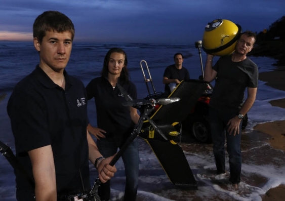
Working with UNSW’s School of Aviation and the NSW Office of Environment and Heritage, Turner had at his disposal a fleet of drones, fixed-wing planes, quadbikes, jet skis, fixed and mobile cameras, airborne LiDAR laser ranging sensors and other equipment to conduct the largest and most detailed pre- and post-storm coastline analysis anywhere in the world.
Every five to 10 minutes, I had to take a step back as more of the beach was receding. I hadn’t seen anything like that before.
Coupled with a vast bank of data collected during the past 40 years at nearby Narrabeen–Collaroy beaches – one of the world’s longest-running, beach erosion monitoring programs – coastal engineers would finally have, it was hoped, enough information to build models that could accurately predict the damage storms would do days before an event.
It would also provide a crucial insight into how climate change would interact with El Niño and La Niña weather cycles, and predict coastal vulnerability from sea-level rise and changing storm patterns in the decades ahead, says senior research associate Kristen Splinter, an engineer and modelling specialist at WRL who builds predictive tools.
The UNSW-led rapid response team was alerted, but Turner held off activating the plan. They needed to be certain: there had been false starts before, when storms looked ominous but then dissipated. Sure enough, the following day’s forecast indicated the storm’s intensity had dropped.
But over the next 24 hours, the tempest brewing off the Queensland coast came back with a vengeance: it was merging with another nearby storm cell, while an intense high-pressure system forming over New Zealand squeezed the storm south along the eastern seaboard. Warmer conditions allowed the air to hold more moisture, while abnormally high sea-surface temperatures beneath added more energy to the seething air mass. East coast lows like these can be ferocious, but they usually arrive from the south: this one would strike from the northeast, hammering normally protected northern-facing coastlines.

Ian Turner inspects a miniature camera on Perranporth beach in Cornwall.
Two days later, on Wednesday, Turner made the decision to mobilise the team. UNSW Aviation’s Piper Seminole twin-engine aircraft, loaded with LiDAR, hyperspectral cameras and position sensors, took off from Bankstown Airport in Sydney’s west and began taking high-resolution scans of key sites along a 500 km stretch of the coast from Sydney to Coffs Harbour.
Meanwhile, Harley and his team deployed drones over Narrabeen–Collaroy, creating high-resolution 3D maps of the 3.6 km long beach, which curves in a gentle, east-facing arc between the 20 m high cliffs at Narrabeen Head in the north to rocks at a low cliff at Collaroy Point, a region peppered with beachfront houses and apartments.
The next day, two jet skis operated by staff from the Office of Environment and Heritage began criss-crossing the water, using echo-sounders and GPS to collect detailed maps of the seafloor, from the high-tide shoreline out to a continental shelf depth of 30 metres. “You need quite calm conditions to do those surveys,” says Harley, “so we were very fortunate that in the whole week before the storm, the water was actually very still.”
While the rapid response team worked feverishly to finish its data gathering, the weather in Sydney was unfailingly pleasant – making it hard to believe an angry squall was imminent. On the afternoon of Friday 3 June, a UNSW wave-rider data buoy was anchored in 10 metres of water about 350 metres offshore, directly in front of – and synchronised with – a cluster of time-lapse cameras mounted on the roof of a beachfront high-rise.
That day, the Bureau of Meteorology warned that widespread heavy rainfall, damaging winds and likely flash flooding would soon hit – even as the sun shone and the oceans were calm.
Harley – a leading researcher in continental shelf dynamics and coastal modelling – had for five years studied the Adriatic coastline just south of Venice while at the University of Ferrara, working on a major European Union project to develop early warning systems that could forecast coastal hazards from storms with a few days’ warning. Collaborating with researchers in Britain, Spain, Portugal, Poland, Bulgaria and Italy, they used supercomputers to develop a series of numerical models that tried to predict how atmospheric weather, wave physics, tides and winds interacted.
While wave forecasts are now incredibly accurate, how all the elements interplay with sediment, coastline and coastal sands is still a challenge. “You have to model billions of sand and sediment particles and how they will shift,” he says.
In 2015, Harley returned to UNSW, where he had earlier completed his PhD, to take over the management of the coastal monitoring program of Narrabeen–Collaroy, one of the best studied beaches in the world where the kind of high-resolution data being collected might help solve the supercomputer’s difficulties. But for that, they needed a very big storm.
And here, finally, it was. That Friday night, the downpour began and the winds tore into the coast, reaching up to 117 km/h on Sydney Harbour. In some areas of the city, 170 mm of rain fell by Sunday morning, and 500 people in Narrabeen and Lismore on the far north coast had to be evacuated as floodwaters rose. Almost 90,000 homes across NSW lost power, and there were 5,500 calls to emergency services. As the night’s king tides combined with savage winds, waves of up to 12 metres in height were reported along the coast, smashing cliffs once thought unreachable – even toppling the foundations of the century-old Coogee surf lifesaving clubhouse on a clifftop.
Harley visited Narrabeen–Collaroy on Saturday night, and had trouble standing against the onslaught of wind. “The waves were hitting the dunes in front of the houses, and the sand was starting to slump,” he says. “Every five to ten minutes, I had to take a step back as more of the beach was receding. I hadn’t seen anything like that before.”
The storm continued unabated on Sunday, leading to an additional 500 evacuations and forecasts for another 100 mm of pounding rain. Trees fell, houses were splintered asunder and brick walls collapsed into the sea. In one stretch of Narrabeen–Collaroy, 50 m of sand disappeared beneath the waves and parts of beachfront houses and businesses fell into the surf in the onslaught from the returning king tides.
At daybreak on Monday 6 June, Harley and Chris Drummond, an engineer at the lab and a certified drone pilot, reached Narrabeen–Collaroy and were surprised it was calm enough to fly sorties – as well as stunned at the extent of the damage.
“It was quite surreal – the winds had completely dropped, and the sky was a magnificent blue,” Harley recalls. “Having studied that beach for 15 years, and theorised about this happening, to actually see the impact in real life was quite incredible. There were still large waves, and a significant amount of erosion occurring, but it was calm enough to fly the drones and capture that erosion as it was happening.”
For the next few weeks, the drones, quadbikes and jet skis measured the beaches, while the equipment-laden Piper Seminole flew surveys above the coastline. Early results suggest this single storm stripped 65 million cubic metres of sand from beach and dunes along NSW’s 990 km of sandy coastline and deposited it in sandbars beneath the waves.
That sand will gradually return, but the researchers finally have the hard data they need: what happened to the sand and when, in response to what forces – like wind speed and direction, wave height and strength. Now begins the mammoth task of building an accurate coastal erosion model the world can rely upon, to predict damage days before a storm hits. It’s not just about protecting beaches; billions of dollars’ worth of infrastructure is threatened by coastal erosion, including buildings, roads, power and water utility corridors, and sewerage lines. As sea levels rise, storm tides reach deeper inland. Erosion models are a crucial line of defence against that destruction.

Grantley Smith in the Iab. Photo Grant Turner/Mediakoo
Three men died in the June storms after being swept away while trying to drive through floodwaters, and there were more than 80 rescues from stranded cars. It’s a growing problem, and one engineers at WRL turned their minds to. Why was it happening more often?
In a world first, they conducted a series of experiments at the lab’s test tanks to understand the force of floodwaters, using real cars instead of vehicle miniatures as other groups had done, and found the answer.
A small car like a Toyota Yaris, weighing just over one tonne, was moved by water only 15 centimetres deep and with a flow speed of just 3.6 kmh; it completely floated away in just 60 cm of water.
Even a 2.5 tonne Nissan Patrol 4WD was rendered unstable by floodwater 45 cm high and a similar flow speed. Once the water reached 95 cm, the vehicle floated like a boat, and was easily pushed around by hand. By contrast, an able-bodied adult is much more stable in flowing water.
“What was surprising was just how little water it took to make even a large vehicle unstable,” says principal engineer Grantley Smith, who led the research. “They became vulnerable to moving floodwaters once the depth reached the floor of the vehicle. Even in low water depths and slow flow speeds, floodwaters had a powerful enough force to make them float away.”
Part of the reason is modern cars are so airtight for air conditioning, they become giant air bubbles when waters rise. Another is that people underestimate the power of moving water.
“Even slow-moving water packs a powerful punch,” says Smith. “Water is heavy: each cubic metre weighs about 1,000 kg. If a house is exposed to floodwaters two metres deep and 20 m wide – travelling at a steady 3.6 kmh – the force is equivalent to being hit by a 40 tonne semi-trailer every 15 seconds.”