Australian scientists led by UNSW remote sensing expert Associate Professor LinLin Ge will have access to high resolution images from Chinese satellites, boosting our capacity to respond to disasters such as bushfires and flooding.
New agreements signed with Chinese authorities provide access to Chinese disaster-monitoring and Earth observation satellites, which will not only help Australian researchers monitor unfolding disasters but improve research capability on a range of environmental issues, such as land degradation, subsidence and water flows.
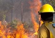
Chinese satellites allow greater area coverage and seven times higher resolution than thermal satellites currently used for example by Australian fire authorities for bushfire monitoring.
UNSW Vice-Chancellor Professor Fred Hilmer and representatives of the CRC for Spatial Information and the NSW Land and Property Management Authority signed Memoranda of Understanding (MOUs) on the satellite access with the China Earthquake Administration and the National Research Centre for the State Administration of Work Safety.
UNSW is recognised as a world leader in satellite image technology. Dr Ge led a team of satellite radar specialists that provided Chinese authorities with vital analysis of the damage caused by last year's devastating earthquakes in China's Sichuan Province.
Dr Ge said the agreements with China will deliver a major improvement in Australia's disaster-response capabilities.
"These MOUs will enable us for example to prepare and plan for the fire season, not just respond to major fires," he said. "The satellites can be pre-programmed to cover potential fire sites and this will make our response faster. The agreements will also allow us to access more satellites so that we can have more frequent observations of any event."
Media contact: Judy Brookman | 02 9385 3249 | j.brookman@unsw.edu.au